Frequently Asked Questions
Find short and useful answers to our most frequently asked questions about destinations like Purnululu National Park (the Bungles), Broome, the Gibb River Road, Karratha and more.
Purnululu National Park (Bungle Bungle Range)
How do I get to the Bungle Bungle?
Access to the park by road is via Spring Creek Track, from the Great Northern Highway approximately 250km south of Kununurra, through Mabel Downs cattle station to the track's end at the Purnululu National Park Visitor Centre.
Why are the Bungle Bungle famous?
Famous for the 450 km2 Bungle Bungle Range, Purnululu has been listed as an outstanding landscape that is an incomparable natural phenomenon. It reveals the story of its formation over hundreds of millions of years, and helps unlock the story of the earth's history.
Who found the Bungle Bungle?
The park is known for the astounding Bungle Bungle range, which was only 'discovered' by a film team in 1983. Purnululu National Park was established in 1987 and skyrocketed to world fame in short time.
What do the Bungle Bungle look like?
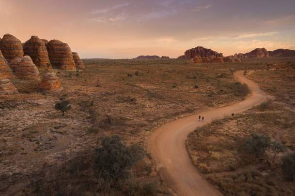
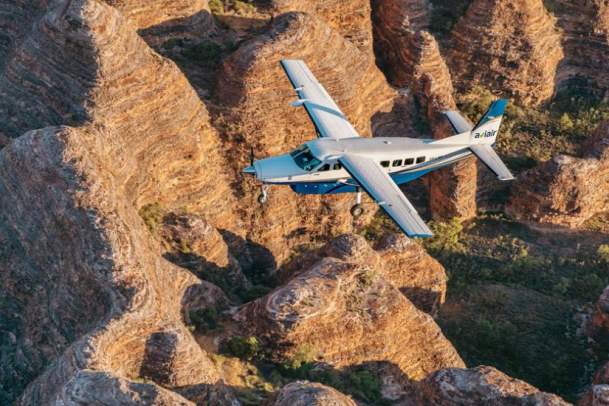
The Bungle Bungle have a distinct orange-and-black-ringed pattern running down their surface. This is caused not only by the conglomerate nature of their make-up but from water getting trapped in denser layers, allowing algae to grow and form the darker colorations.
How tall are the Bungle Bungle?
The average height of the Bungle Bungle range is approximately 200-300 metres high and seems even higher whilst walking through the gorges and chasms.
What are the Bungle Bungle made of?
The distinctive beehive-shaped towers are made up of sandstones and conglomerates (rocks composed mainly of pebbles and boulders and cemented together by finer material). These sedimentary formations were deposited into the Red Basin 375 to 350 million years ago, when active faults were altering the landscape.
Gibb River Road
When was the Gibb River Road constructed?
While the Gibb River Road as we know it today was constructed in the 1960’s, pastoralists had previously constructed two unsealed tracks linking Derby with Mt House station in the west, and Wyndham with Karunjie Station, Gibb River Station and Kalumburu in the east. Both tracks (known as the Mt House Road and Karunjie Track) were hand hewn roadways wide enough for bullock wagons, and for drovers with their cattle herds.
Why was the Gibb River road constructed?
The Gibb River Road was constructed as part of the “Beef Roads Programme” which was set up by the government in 1949 to provide funding for the construction of infrastructure to support the beef industry. This programme, and under the supervision of Main Roads WA teams of surveyors, engineers and labourers, set out on an arduous 3 year road-building project.
How long is the Gibb River Road?
The Gibb River Road is 660km in length, between Derby and Kununurra. The majority of the road is gravel and the condition is dependent upon the previous wet season, traffic and the last time a grader repaired it. To really do it justice, allow yourself at least two weeks to have the best experience.
What is the best time of the year to do the Gibb River Road?
Between the months of April and November is considered peak tourist season meaning that most tourist operators and services are fully operational.
Do you need a 4WD to do the Gibb River Road?
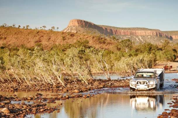
A four-wheel drive is required to tackle the Gibb River Road, but for the majority of the time not for the reasons you'd expect. Tracks can become highly corrugated and testing of a vehicle's basic faculties along the Gibb River Road, making a true four-wheel drive the logical choice.
Does your car need a snorkel to do the Gibb River Road?
At the start of the season, and depending on the rainfall over the wet season a snorkel may be required for certain crossings for a short time. For the majority of the season, yYou won’t need a snorkel for river crossings on the Gibb River Road, but if it’s very dry your air filter would not get quite as dusty if you had one.
Karratha
Can you swim in the ocean at Karratha?
Karratha has several beaches, such as Whitnell and King Bay where you can swim at any time. There are plenty of fresh water swimming holes within an hours drive of Karratha as well.
Does Karratha have crocodiles?
Generally no. Crocodiles are rarely sighted a couple of hundred km away from Karratha. However, the Kimberley and Pilbara regions are considered crocodile country.
Where can I snorkel in Karratha?
Point Samson is known to the locals as 'The Oasis of The Pilbara'. Point Samson hosts beautiful beaches, whale watching, fishing, snorkelling, swimming, coral garden reefs, bird watching, kayaking and canoeing, walk heritage trails.
What is the one must do thing in Karratha?
Visit the Murujuga Rock Art. The Traditional Owner groups of the Burrup Peninsula and surrounding areas are pleased to showcase their culture and extensive Rock Art petroglyphs.
Traditional custodian guides will give you the opportunity to experience not just the ancient Rock carvings but also their stories and explain how they lived in harmony with the land through their bush tucker and medicine interpretation.
How do I get to Karratha?
By air - Karratha is well serviced by Qantas and Virgin with multiple flights a day from Perth. Aviair offers regular passenger services through their Inter Regional Flight Network, connecting Karratha with Broome, Newman and Port Hedland multiple times a week.
By road - The North West Coastal Highway connects Karratha to Perth from the south and Broome from the north. This major sealed road is one of the many high-quality roads that connects the region.
By coach - Integrity Coachlines provides scheduled coach services from Perth and Broome.
What is the Aboriginal history of Karratha?
Karratha and the West Pilbara Coast of WA have a fascinating Aboriginal history and cultural heritage. Home to the Ngarluma and Yinidbarndi people for many generations, the locals acknowledge them as the region’s traditional landowners.
Millstream-Chichester National Park, the Jaburara Heritage Trail, Deep Gorge and the Burrup Peninsula are fascinating places to discover the Aboriginal history of Karratha and WA’s West Pilbara Coast. Over 40,000 rock engravings (petroglyphs) can be viewed in the region, many of which are located on the Burrup Peninsula.
What does the word Karratha mean?
Taking its name from one of WA’s early pastoral stations, from which the land was resumed, Karratha is an Aboriginal word meaning “good country” or “soft earth”. For many centuries, the region has been home to Aboriginal communities, and the nearby Burrup Peninsula features the world’s most prolific Aboriginal rock engraving sites, with over 10,000 identified examples.
Is Karratha worth visiting?
Red-hued earth, deep gorges, and pretty beaches: Karratha quite literally has it all. ... It's arguably one of the region's most beautiful beaches, and perfect for a day of swimming, fishing, and picnicking with family and friends.
What to do in Karratha?
Old Roebourne Gaol, Yaburara Heritage Trail, Millstream, Karijini, Local Lookouts, Mt Herbert, Wittenoom Road, Chichester Ranges, Roebourne, Burrup Peninsula, Picnic areas and parks, Beaches, Staircase to the Moon, Dampier Archipelago, Montebello Islands and more!
Horizontal Falls
What are the Horizontal Falls?
The Horizontal Falls are fast moving tidal currents that squeeze through two narrow gorges of the McLarty Range in Talbot Bay, located in the Buccaneer Archipelago. They are waterfalls ‘turned on their side’.
Are the Horizontal Falls accessible by vehicle?
The Horizontal Falls are not accessible by vehicle. You can view the Horizontal Falls from the air with a scenic flight or helicopter flight from Broome or Derby. There are also tours that include the flight from Broome or Derby (some by float plane) and a speed boat ride to and through the Falls themselves.
Do tours to the Horizontal Falls run year-round?
Tours which include the speed boat ride through the Falls run seasonally, from around March to November each year. Scenic flight tours which include an overfly of the Horizontal Falls run year-round.
Do the Horizontal Falls flow in one direction?
The direction of the flow reverses according to the tides, which can reach more than 10 metres in the Kimberley. The falls are also reversible. Each day, when the tide turns, the falls flow in the opposite direction.
What is the difference in tides at the Horizontal Falls?
Daily tidal flow through the Horizontal Falls can be more than 10m on each tide. There are spring tides and neap tides. During spring tides the water flows rapidly through the falls. During neap tides there is a weak tidal movement so those on a boat will experience a more mellow water flow. King Tides occur twice a year –between March and April and again between September and October, and at these times the difference between high and low tides is even greater.
How wide are the Horizontal Falls?
The most seaward opening is around 20 metres wide and the more inland gorge is around 12 metres wide.
Is a tour to the Horizontal Falls suitable for families with children?
Yes, we advise contacting the tour operator about the minimum age of children.
How long is the flight from Broome or Derby to the Horizontal Falls?
The flight from Broome to Talbot Bay takes approximately 1hr 15 minutes. Flights departing from Derby take approximately 40 minutes.
How long is a tour to the Horizontal Falls?
Tours to the Horizontal Falls are of different durations - half-day, full-day, overnight and 24 hour stays, depending on the tour operator and tour option chosen.
What is the temperature at the Horizontal Falls?
The average temperature is about 33 degrees Celsius, though cruising on the water will bring fresh air.
What is the cultural value of the Horizontal Falls?
The Horizontal Falls are situated in the ancestral country of the saltwater Dambimangari people. The land is Aboriginal Reserve Land, reserved for the use and benefit of Aboriginal people, and they have exclusive possession native title over the area. The Dambimangari people chose the name Lalang-garram, being a Worrorra word meaning ‘the saltwater as a spiritual place as well as a place of natural abundance’, relating to the ocean in a general sense. The Lalang-garram /Horizontal Falls Marine Park was created in 2016 as part of the Kimberley Science and Conservation Strategy.
Kimberley Tours
Where is the Kimberley?
The Kimberley (sometimes called the Kimberleys) is located in the north western part of Western Australia, stretching from south of Broome, east across the Great Sandy and Tanami Deserts to the Northern Territory border close to Kununura and Lake Argyle.
How big is the Kimberley?
The Kimberley region covers an area of approximately 423,517 square kilometres (163,521 sq mi). In context, this is approximately twice the size of the state of Victoria, over three times the size of England, and slightly smaller than the state of California. The Kimberley population is 36,230.
What is the best time to visit the Kimberley?
The most popular time to visit the Kimberley is from May to October, the Winter or Dry Season. During this time daytime temperatures range from 20°C to 30°, all tours and attractions are open, and regular direct flights operate from the East Coast of Australia to Broome. It's possible to visit the Kimberley year-round, although in the Wet Season (approximately November to April) some attractions cannot be accessed due to closed roads and local flooding, and the daily temperatures are hot.
What is there to see between Kununurra and Broome?
There are two main options for travel between Kununurra and Broome - the Great Northern Highway via Halls Creek and Fitzroy Crossing, or the Gibb River Road. Along the Great Northern Highway, attractions include the Bungle Bungle Range in Purnululu National Park, Wolfe Creek Crater on the Tanami Road, Danggu Geike Gorge in Fitzroy River Crossing, and Bandlignan (Windjana Gorge) and Dimalurru (Tunnel Creek) via the Leopold Downs Road. Along the Gibb, attractions include El Questro, the Cockburn Ranges, Manning and Bell Gorges, and access to the Mitchell Falls via the Kalumburu Road. Many tour itineraries and self-drive trips aim to include as many attractions as possible by travelling the Gibb and Great Northern Highway in a loop.
Kimberley & Pilbara Holiday Planner
Your Guide to Broome, the Kimberley and Pilbara. With travel tips, itineraries, national park…
Getting To The North West
A growing number of direct interstate flights and cheaper services between Perth and Broome means…
Itineraries
The diverse landscapes of Broome, the Kimberley region and the Pilbara region create an amazing…
Important Travel Tips
For a safe and enjoyable holiday in the North West, check out these important travel tips.
Weather & Climate
The weather and climate in the Kimberley and Pilbara regions of Australia's North West vary…
Getting Around The North West
If you have limited time, a quick, easy and scenic way to travel around Australia’s North West…
Maps
Whether you’re at the start of your trip planning or about to start your adventure a good…
Travel Specialists & Visitor Centres
Book and plan your trip to the North West with the experts. Travel agents and visitor centres…
Subscribe to Our Newsletter
Sign up to our newsletter & you'll receive special offers, travel inspiration and expert…
Holiday Offers
Find the latest deals, special offers and packages for accommodation and tours in Broome, the…


